APOLOGIES TO ALL HAVING ISSUES PREVIOUSLY. THIS HAS NOW BEEN RESOLVED AND THE APP NOW PROVIDES ALL THE POI’s.

A lot of last years attendees have complained all over social media about the poor map that was provided by the official EE Glastonbury app. The fact that no-one could get a mobile signal only compounded more frustration especially where 200,000 revellers are all trying to utilise the same mobile phone mast and the fact that there is no offline interactive map.
Well this year we are providing a FREE map that can be used with a FREE 3rd party app which is available on both iPhone and Android and which will allow navigation to all the festivals landmarks/waypoints without the need for a signal which will include but not be limited to;
- Stages
- Campsites
- Water points
- Food outlets
- Bars
- Toilets
- Personal markers which will allow you to pin your tent location and get directions back wherever you are on site (no matter how partied up you are!!)
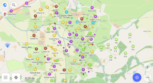
The app will also provide you with the ability to filter waypoints, edit details and provide information including distance to waypoints, time to waypoints and even the elevation of the walk
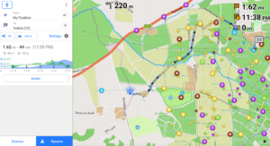
So here’s our quick and easy guide to installing and using the app.
Step 1 – Download and install map app to your device
For this we use OsmAnd which is free for both Android and iPhones/Pads (click on link below).

OsmAnd
CLICK HERE FOR GOOGLE PLAY
CLICK HERE FOR APP STORE
Download, install and open the app.
Step 2 – Select the correct map area
Once you have opened the app you will be given an option to download your local area map. If you don’t want this then press the SKIP DOWNLOAD button.
You will then be presented with a screen and in the left hand bottom corner an OPTIONS button (box with 3 lines).
For Android press the OPTION button and then click DOWNLOAD MAPS
For iPhones press the OPTION button then MAPS AND RESOURCES

Then select the following – EUROPE -> UNITED KINGDOM -> ENGLAND -> SOUTH WEST ENGLAND -> STANDARD MAP (Android) / MAP (iPhone)
This will now automatically download the area for Glastonbury.
Step 3 – Download and Install the Glastonbury Festival Map
Go back to the main screen, zoom out and you should be presented with a screen that looks like this.
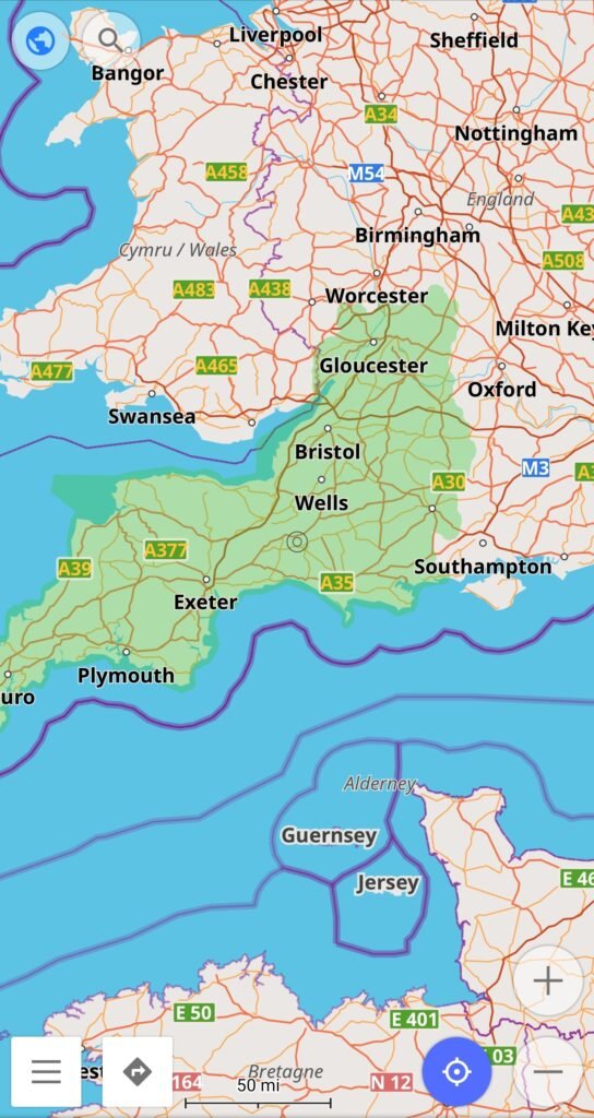
From here we can now download and install the Glastonbury Festival map. This will be called Glasto Map 2023.osf
Click on the icon below to download the Glastonbury Festival map.
It may warn that Google cannot scan for viruses, don’t worry we have checked this file prior to uploading.
Map Release Notes:
V3 – All POI’s now showing up.
V2 – We have updated the file to reduce size (duplicate map) and include all camp sites and update certain POI’s.
V1 – Initial release
Once downloaded press the OPTION button. From here select SETTINGS. At the bottom of the settings page is an option called IMPORT FROM FILE (Android) or RESTORE FROM FILE (iPhone). Press this then select the file named Glasto Map 2023 from where the file has been downloaded to on your device (usually DOWNLOADS).
Once transfered you will be presented with a screen asking you to select data to be imported. Select all tick boxes and press continue.
On the next option it will ask if you want to keep or replace data, click replace and your done. Now we have the data installed it’s time to start configuring.
Step 4 – Filtering points of intrest (POI’s)
When you go back to your map, zoom in on Glastonbury and there will be a plethora of POI’s as shown below.
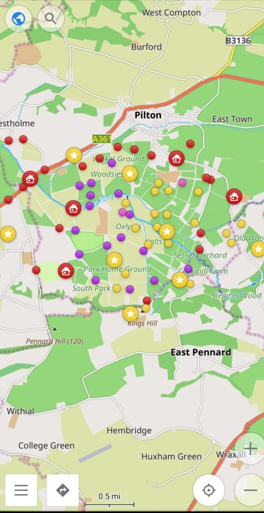
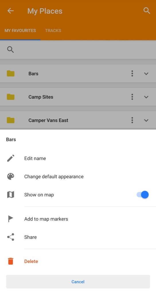
To filter these to what you want to see simply press the OPTIONS -> MY PLACES -> 3 DOTS BUTTON (next to each place on Android) and deselect the ones that you do not want to show. Unfortunately this option is not available on iPhone.
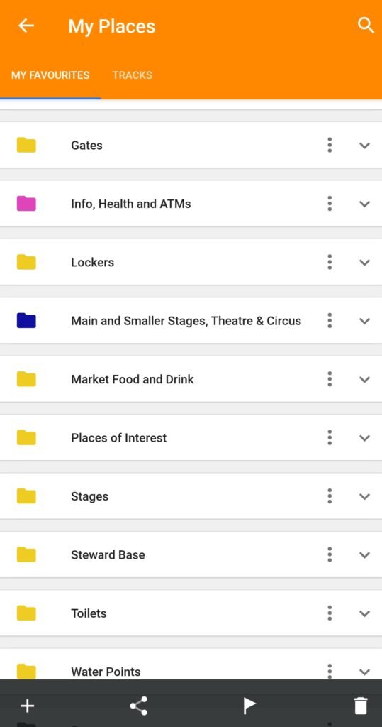
From this screen simply select the POI’s you want showing
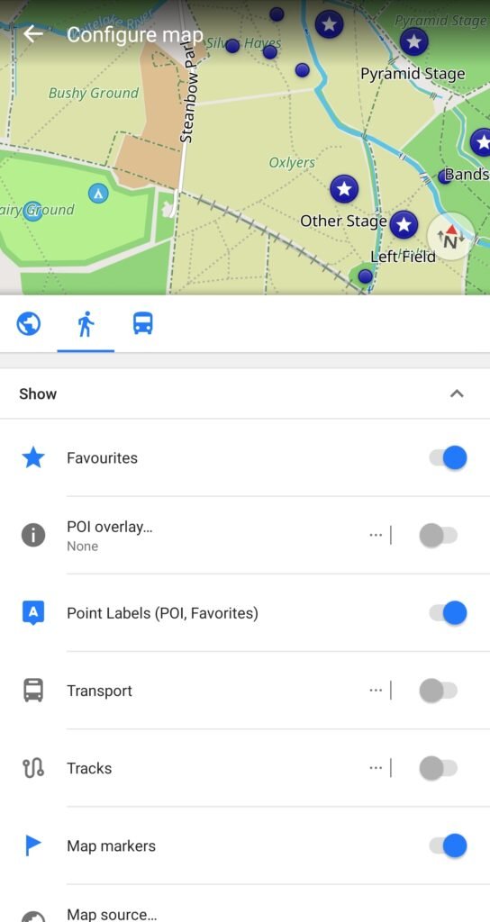
You may also want to show the POI labels on the map. If these aren’t already shown then to do this press OPTION -> CONFIGURE MAP -> POINT LABELS (POI, FAVOURITES)
Step 5 – Using the navigation feature
Not too dissimilar to Google Maps the navigation feature is easy to use but before selecting NAVIGATION it’s best to configure the map just to show walking routes.
Select OPTION -> SETTINGS and deselect both car and cycling. This will then only provide walking routes for the festival.
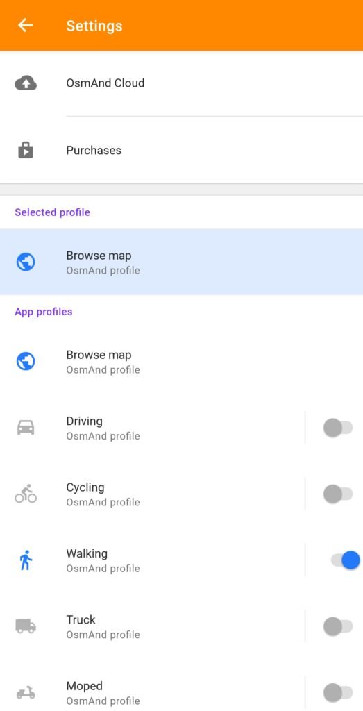
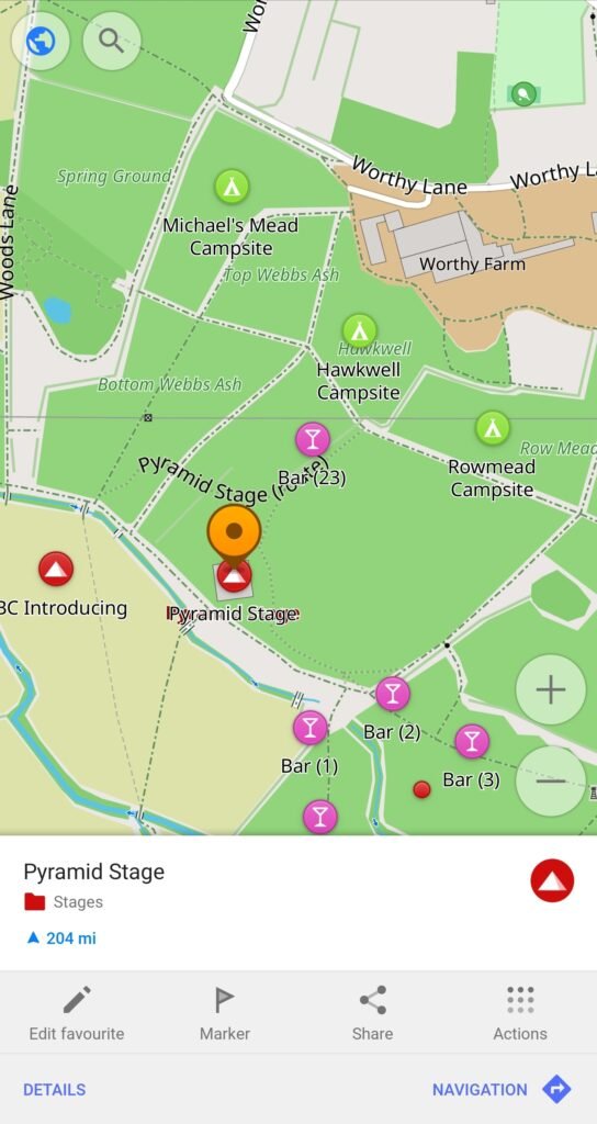
There are a few ways to use the NAVIGATION feature.
- Simply pess select a POI on the map and select the NAVIGATION button
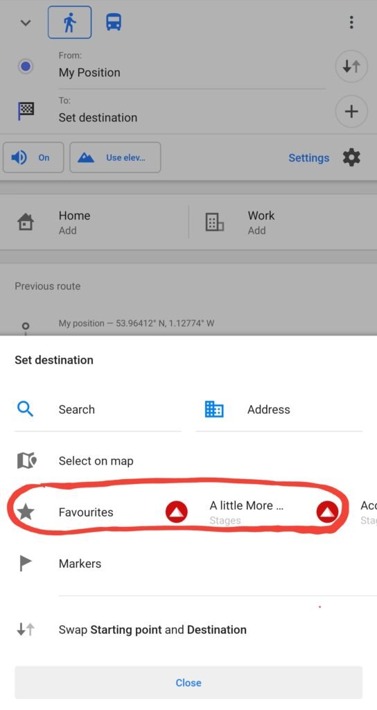
2. From the OPTIONS screen press the NAVIGATION tab and scroll through the FAVOURITES tab and select your required destination then press the NAVIGATION button
3. Use the search bar at the top but this will also show places that are not confined to Glastonbury and again select the NAVIGATION button.
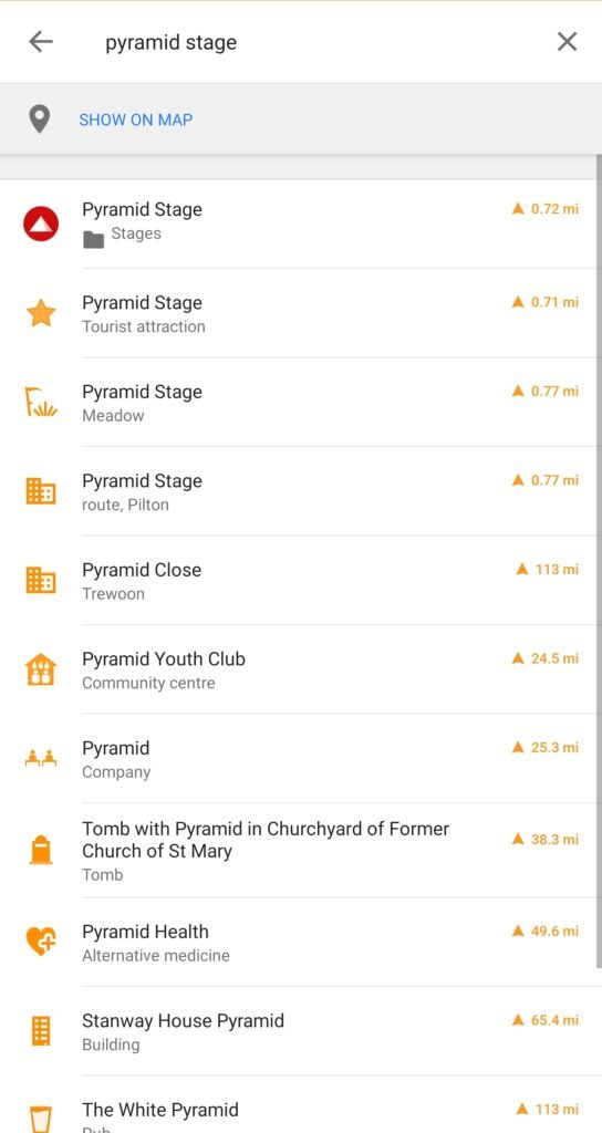
These may differ alittle from device to device.
And that’s it. These are the basic functions that should help you when at Glastonbury. What we would say is that when you have the map setup play around with it. There are lots of features on the app that let you configure things to your likeing such as overlays, map types, editing POI’s etc, which will allow you to get the most from the app.
We have also provided a guide on how to add POI’s such as you tent or car. Always a good thing when you’ve had a few too many and need a hand to get you back to your tent. You can find this guide HERE.
Hope this is of use and remember you don’t need a signal for this to work, its completely offline.
Map Release Notes:
V3 – Stages missing from app within sub folder. Now available on the map.
V2 – We have updated the file to reduce size (duplicate map) and include all camp sites and update certain POI’s.
V1 – Initial release
Let us know your thoughts below.


Hi! When adding the osf file i have only two options to tick (Profiles and Settings) and not 3 as mentioned in the tutorial. I add them both , then go and press replace but no POI appear on the map of Glastonbury. Am I doing something wrong. Android – Pixel 7. Thanks
Dan thanks for your comment. We have had issues with the file in question. This has now been updated and should now work. Any more issues please let us know.
I confirm it’s working. Happy Glasto!
Hope it’s of use!!